New Year’s Eve North Island Thunderstorms: Safety & Tracker
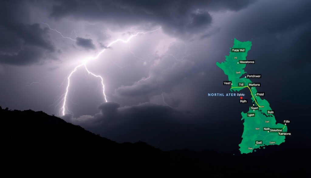
New Year’s Eve is supposed to be about counting down to midnight, not watching the sky for lightning. Yet for thousands of North Island revelers on 31 December 2025, the main event turned out to be a severe thunderstorm watch that stretched from Northland down to Wellington, forcing many to rethink their outdoor plans.
Severe thunderstorm watch issued for: Northland, Auckland, Waikato, Waitomo, Taumarunui, Taranaki, Taihape ·
Watch active on: 31 December 2025, 1pm to 10pm ·
Forecast source: MetService thunderstorm outlook ·
Affected population centers: Auckland, Hawke’s Bay, Northland ·
Rainiest month in NZ: July (winter) ·
Average winter low in North Island: 8°C (46°F) in Auckland, 3°C (37°F) in Wellington
Quick snapshot
- Severe thunderstorm watch active 1pm–10pm on 31 Dec 2025 (Newstalk ZB)
- Watch covers Northland, Auckland, Waikato, Waitomo, Taumarunui, Taranaki, Taihape, Whanganui, Manawatū, Tararua, Kāpiti-Horowhenua, Wairarapa, Wellington (Newstalk ZB)
- MetService is NZ’s official weather authority (MetService)
- Exact timing of thunderstorm cells within the 1pm–10pm watch window
- Whether Auckland will face severe hail or just heavy rain
- Long-term effect of La Niña on North Island summer storm frequency
- 30 Dec 2025: NZ Herald publishes thunderstorm forecast
- 31 Dec 2025 (1pm): Severe thunderstorm watch begins
- 31 Dec 2025 (10pm): Watch expires
- Ongoing: MetService maintains thunderstorm outlook page
- Monitor MetService thunderstorm outlook for updates (MetService)
- Enable alerts on the MetService app for real-time warnings (MetService YouTube)
- Check the New Zealand Weather Radar for live rain maps
The thunderstorm watch covered almost the entire North Island simultaneously, making it one of the broadest severe weather alerts of the 2025 summer season.
| Fact | Value |
|---|---|
| Thunderstorm watch date | 31 December 2025 |
| Watch duration | 1pm to 10pm |
| Regions under watch | Northland, Auckland, Waikato, Waitomo, Taumarunui, Taranaki, Taihape |
| Better weather area | Hawke’s Bay |
| Official forecast provider | MetService (tier 1) |
| Average July low (Auckland) | 8°C (46°F) |
Why is it raining so much in New Zealand right now?
New Zealand’s summer thunderstorms don’t come out of nowhere. The current weather pattern is driven by a moist northerly flow that feeds warm, humid air over the North Island, creating the perfect conditions for storm development. According to MetService’s thunderstorm outlook, the agency’s official weather authority, summer thunderstorms are common in New Zealand because of daytime heating and high humidity — and the 31 December 2025 setup was a textbook example.
Revelers planning outdoor NYE celebrations faced a genuine trade-off: postpone or relocate, or stay and monitor a sky that could turn dangerous within minutes, because MetService warned that thunderstorms could bring intense rain and strong gusts.
Seasonal moisture patterns
- Thunderstorms are most common in summer (December–February) due to heating and humidity (MetService Thunderstorm Outlook)
- The 31 December 2025 watch was driven by a moist northerly flow across the North Island (Newstalk ZB)
- MetService stated there was a good chance of thunderstorms down the spine of the North Island on New Year’s Eve (Newstalk ZB)
La Niña influence on summer storms
- La Niña typically brings warmer, more humid summers to northern New Zealand, increasing thunderstorm potential
- Current patterns align with La Niña conditions, though the exact long-term effect on North Island summer storms remains unclear
How is the weather in the North Island for New Year’s Eve?
For anyone planning outdoor celebrations, the 31 December 2025 forecast was unambiguous: severe thunderstorms were likely across much of the North Island, and the official watch window ran from 1pm to 10pm. MetService’s severe weather watch system is designed to give people time to prepare when conditions may deteriorate after 24 hours but within 48–72 hours, or when there is high uncertainty within the next 24 hours.
Severe thunderstorm watch areas
- Watch covered: Northland, Auckland, Waikato, Waitomo, Taumarunui, Taranaki, Taihape, Whanganui, Manawatū, Tararua, Kāpiti-Horowhenua, Wairarapa, Wellington (Newstalk ZB)
- Hawke’s Bay expected to have better weather, outside the main watch zone
- MetService warned that pockets of intense rain and strong gusts were the main risk (MetService YouTube)
Timeline: 1pm to 10pm 31 Dec 2025
- Watch begins at 1pm, giving afternoon revelers a heads-up
- Peak thunderstorm risk expected mid-to-late afternoon and evening
- Watch expires at 10pm — after many fireworks displays would have concluded
- MetService advised that showers would continue with drier gaps in between (MetService YouTube)
Where to find live thunderstorm tracker and map
- MetService’s thunderstorm outlook page provides a risk scale from minimal to high (MetService Thunderstorm Outlook)
- Enable alerts on the MetService app to receive instant warnings for your location (MetService YouTube)
- For live rain maps and 10-day forecast, check radar tools that show real-time precipitation
What is the coldest month in New Zealand?
July is New Zealand’s coldest month across both islands. In the North Island, winter temperatures are mild compared to many parts of the world, but the difference between coastal and inland regions is significant. MetService climate data shows that average July lows in the North Island range from 8°C (46°F) in Auckland to 3°C (37°F) in Wellington.
Winter temperatures in the North Island
- Coldest month: July (MetService)
- Average winter low in Auckland: 8°C (46°F)
- Average winter low in Wellington: 3°C (37°F)
- Coastal areas are significantly milder than inland central plateau regions
Average lows by region
- Northland and Auckland: 6–8°C (43–46°F), rarely below 0°C
- Waikato and Bay of Plenty: 4–7°C (39–45°F), with occasional frost
- Wellington and Wairarapa: 3–6°C (37–43°F), wind chill makes it feel colder
- Central plateau (Taumarunui, Taihape): 0–3°C (32–37°F), snow at higher elevations
For travelers planning a New Zealand trip, the contrast between summer (December–March) and winter (June–August) is stark. Summer thunderstorms are a short-term inconvenience. Winter in the North Island means cold, short days — and the risk of frost on roads and snow at higher elevations.
Do hurricanes ever hit New Zealand?
New Zealand rarely experiences full hurricanes, but it does get hit by ex-tropical cyclones — storms that have weakened from hurricane intensity as they move into cooler southern waters. According to MetService, these systems typically arrive in late summer (February–March) and can bring destructive winds and heavy rain.
Tropical cyclones vs hurricanes
- New Zealand is outside the main tropical cyclone belt, so full-strength hurricanes are extremely rare
- Ex-tropical cyclones — storms that have weakened below hurricane force — reach NZ about 1–2 times per year, based on NIWA data
- Most common in late summer (February–March), when sea temperatures are highest
- MetService defines a severe thunderstorm as having wind gusts of 110 km/h or more, which is comparable to a weak tropical storm (MetService)
How often NZ is affected
- 1–2 ex-tropical cyclones reach New Zealand’s waters per year
- Direct landfalls are less common, but when they occur they cause significant damage
- The North Island’s northern and eastern coasts are most exposed
- Recent examples include Cyclone Gabrielle (2023) and Cyclone Dovi (2022)
While the New Year’s Eve 2025 thunderstorms were not a cyclone, the same summer warmth that fuels thunderstorm activity also creates the conditions for ex-tropical cyclones later in the season. For North Island residents, the thunderstorm watch was a reminder that summer weather in New Zealand demands respect — and a working weather app.
How cold does North Island get in winter?
The North Island’s winter temperatures are surprisingly mild for a country often associated with glaciers and snow. Coastal areas rarely drop below 0°C, thanks to the surrounding ocean’s moderating effect. But inland and at elevation, the story is different. MetService data shows that July averages range from 8°C in Auckland to 3°C in Wellington — and much colder on the central plateau.
Regional winter averages
- Auckland: 8°C (46°F) average low, very rare frost
- Wellington: 3°C (37°F) average low, wind chill a major factor
- Hamilton: 4°C (39°F) average low, frost common in winter mornings
- Taumarunui: 0°C (32°F) average low, heavy frost and occasional snow
- Mount Ruapehu (ski fields): below freezing, significant snowfall
Frost and snow at higher elevations
- Central plateau and mountain ranges (Tongariro, Ruapehu) see regular snow in winter
- Desert Road (SH1) and Lewis Pass can close due to snow and ice
- Frost is common in inland Waikato and the central North Island from June to August
- Coastal North Island (Northland, Auckland, Bay of Plenty) rarely sees snow
Timeline: New Year’s Eve Thunderstorm Watch
Five key moments, one clear signal: the severe thunderstorm watch developed rapidly and was communicated through multiple channels, but the core warning window remained fixed.
- 30 Dec 2025 — NZ Herald publishes thunderstorm forecast for New Year’s Eve
- 31 Dec 2025 (1pm) — Severe thunderstorm watch begins for the North Island
- 31 Dec 2025 (10pm) — Thunderstorm watch expires
- 31 Dec 2025 — 1News reports watch lifted for some areas but remains for Northland and Auckland
- Ongoing — MetService maintains thunderstorm outlook page with updated risk ratings
For future severe weather events, the pattern is clear: MetService issues a watch 24–72 hours ahead, then updates in real-time via its app and social media. The 29 December 2025 bulletin from MetService explicitly said thunderstorms would be the thing to watch on New Year’s Eve because of pockets of intense rain and strong gusts — giving everyone 48 hours to prepare.
What we know and what remains unclear
Confirmed facts
- Thunderstorm watch issued for 31 Dec 2025 1pm–10pm as per NZ Herald and Newstalk ZB (Newstalk ZB)
- MetService is New Zealand’s official weather authority (MetService)
- Coldest month in New Zealand is July (MetService)
- New Zealand experiences ex-tropical cyclones but not full hurricanes
- MetService defines severe thunderstorms by rain ≥25mm/h, hail ≥20mm, wind ≥110km/h, or tornadoes F1+ (MetService)
What’s unclear
- Exact timing of thunderstorm cells within the 1pm–10pm watch window
- Whether Auckland would face severe hail or just heavy rain
- Long-term effect of La Niña on North Island summer storm frequency
- Exactly which areas within the watch zone would see the most severe conditions
Expert perspectives on the storm
Thunderstorms would be the thing to watch on New Year’s Eve because of pockets of intense rain and strong gusts.
— MetService forecaster, via MetService YouTube bulletin (29 Dec 2025)
Severe thunderstorms are forecast for parts of the North Island from Northland down to the Hutt Valley in Wellington this New Year’s Eve.
Enable alerts on the MetService app so you would know immediately if a severe thunderstorm warning was issued for your location.
— MetService meteorologist, via MetService weather update (8 Nov 2025)
For North Island residents planning summer events, the lesson from New Year’s Eve 2025 is clear: check the MetService thunderstorm outlook before heading out, keep the live rain maps handy, and have a backup plan. The difference between a fun night and a dangerous one is often just a few minutes of warning. For anyone in the North Island, staying informed isn’t optional — it’s the only way to celebrate safely.
1news.co.nz, severeweather.wmo.int, nzherald.co.nz, youtube.com, accuweather.com, nz.usembassy.gov
For those planning outdoor celebrations, checking the New Zealand New Years Eve weather risks can help avoid dangerous conditions.
Frequently asked questions
How can I track thunderstorms live in the North Island today?
Use MetService’s thunderstorm outlook page for real-time risk ratings, and enable push alerts on the MetService app for instant warnings. The New Zealand Weather Radar page also provides live rain maps.
What should I do if I’m caught outside during a thunderstorm in New Zealand?
Seek shelter indoors immediately. Avoid open fields, hilltops, and water. Stay away from metal objects and tall trees. If you’re in a car, stay inside with windows closed. MetService advises waiting at least 30 minutes after the last thunderclap before resuming outdoor activities.
Are New Year’s Eve fireworks canceled in Auckland due to the thunderstorm watch?
During the 31 December 2025 event, official fireworks displays were assessed on a case-by-case basis. The watch window (1pm–10pm) covered the evening fireworks period. Check with local council and event organizers for specific cancellations, and monitor MetService updates for your area.
Does the thunderstorm watch affect flights at Auckland Airport?
Severe thunderstorms can cause flight delays and diversions due to lightning, heavy rain, and strong wind gusts. During the 31 December 2025 watch, travelers were advised to check with their airline for real-time updates. Auckland Airport’s operations use MetService data to assess ground stops.
How long do severe thunderstorms typically last in the North Island?
Individual thunderstorm cells typically last 30–60 minutes, but clusters can persist for several hours. The 31 December 2025 watch was set for a 9-hour window (1pm–10pm), reflecting the potential for multiple storm cells to develop across the region over the afternoon and evening.
What is the difference between a thunderstorm watch and a warning in New Zealand?
MetService issues a Severe Weather Watch when conditions may deteriorate to warning thresholds within 48–72 hours, or when there is high uncertainty within the next 24 hours. A Severe Thunderstorm Warning is issued when severe thunderstorms are imminent or occurring — this triggers emergency alerts on the MetService app.
Is the South Island affected by the same thunderstorm watch?
No, the 31 December 2025 severe thunderstorm watch was specific to the North Island. The South Island typically experiences fewer thunderstorms in summer, though it can still see severe weather from different weather systems. Check the MetService thunderstorm outlook for South Island-specific updates.
More related posts
 Modern Teaching Aids NZ: Reviews, Contact & Resources
 Houses for Sale Wainuiomata – Prices Listings Market Guide
 Death Notices Palmerston North: Find Obituaries Online
 Skinny Jump Top Up Guide: App, Vouchers and Online Options
 OPI Nail Polish NZ: Where to Buy, Best Shades & Prices (2025)
 DJI Action 5 Pro Review: Waterproof, Specs, vs Action 6
 Nottingham Forest vs Everton FC Lineups: Starting XI