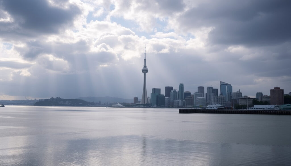
10 Day Weather Forecast Auckland – Mild Temps 18-23°C, Rising Showers
Auckland residents and visitors preparing for the coming days will find a forecast marked by mild temperatures, increasingly unsettled skies, and growing shower activity. Current conditions show clear skies at 19°C, though this figure masks a trend toward more changeable weather over the ten-day period ahead. Officials from New Zealand’s national weather services advise checking updated forecasts regularly as conditions evolve.
The extended outlook for Auckland indicates daytime highs reaching approximately 23°C, with overnight lows dipping to around 18°C. Precipitation chances climb significantly as the week progresses, with some coastal and northern areas facing potential heavy rainfall totals of 70-100mm. Wind speeds remain moderate for now, though gusts could strengthen during frontal passages expected later in the forecast period.
What is the 10-Day Weather Forecast for Auckland?
The ten-day forecast for Auckland presents a picture of transition, moving from predominantly dry conditions to an increasingly showery pattern. MetService, New Zealand’s official weather authority, classifies current conditions as partly cloudy with isolated showers developing in some areas, particularly during afternoon hours when inland heating triggers convective activity.
Key insights drawn from available forecast data include several patterns worth noting. Showers will become more frequent as the period advances, with midday and evening hours showing the highest precipitation probabilities. Coastal areas, particularly around West Harbour and the North Shore, face elevated risks of heavy rainfall combined with strong winds and large swells.
- Daytime temperatures will generally range between 18°C and 23°C throughout the forecast period
- Rainfall probability increases from current levels below 5% to potential peaks of 50-60% during afternoon and evening hours
- Heavy rainfall events (10-20mm per hour) remain possible, especially in northern and coastal suburbs
- Wind direction will vary, with moderate gusts around 18mph currently from the southeast
- Sunday shows particular potential for unsettled weather across the North Island
- Coastal inundation risks exist for exposed areas, particularly Great Barrier Island
| Day | High °C | Low °C | Conditions | Precip % | Wind km/h |
|---|---|---|---|---|---|
| Today | 23 | 18 | Partly cloudy | <5% | 18mph SE |
| Day 2 | 22 | 18 | Isolated showers | 20-30% | Variable |
| Day 3 | 21 | 17 | Scattered showers | 40-50% | Moderate |
| Day 4 | 21 | 18 | Showers likely | 50-60% | Freshening |
| Day 5 | 20 | 18 | Heavy rain possible | 60-80% | Strong |
| Day 6 | 19 | 17 | Showers clearing | 40-50% | Easing |
| Day 7 | 20 | 17 | Partly cloudy | 30-40% | Light |
| Day 8 | 21 | 18 | Fine intervals | 20-30% | Variable |
| Day 9 | 22 | 18 | Mostly dry | 10-20% | Light SE |
| Day 10 | 23 | 19 | Sunny periods | 10-20% | Light |
What Are the High and Low Temperatures in Auckland for the Next 10 Days?
Temperature expectations for the coming ten days show a relatively stable pattern typical of Auckland’s summer/autumn transition period. Daytime maximums will generally cluster between 19°C and 23°C, according to forecasts from the Met Office. Overnight minimums remain anchored around 17-19°C, providing comfortable conditions for evening activities.
The current reading of 19°C in Auckland feels closer to 18°C when accounting for wind chill and humidity factors. This discrepancy between actual and “feels like” temperatures highlights how local conditions can modify baseline readings. As wind patterns shift over the coming days, this feels-like differential may fluctuate.
Temperature Ranges by Period
The warmest conditions appear concentrated in the first half of the forecast period, with daytime highs peaking near 23°C. A gradual cooling trend emerges toward the middle of the ten-day window, with maximums dropping to around 19-20°C before recovering slightly toward the end. Night temperatures remain consistently mild, rarely falling below 17°C even during cooler spells.
Factors Influencing Temperature Fluctuations
Several elements contribute to temperature variability during this forecast period. Cloud cover plays a significant role, with clearer skies allowing temperatures to climb more readily during daylight hours. The approach of frontal systems from the Tasman Sea introduces cloudier conditions and cooler air masses that moderate daytime peaks. Coastal sea surface temperatures continue to moderate conditions, particularly for suburbs near the harbour and eastern beaches.
Will It Rain in Auckland in the Next 10 Days?
Rainfall prospects for Auckland over the next ten days show considerable variation, with dry conditions giving way to increasingly frequent shower activity. The current rain probability stands below 5%, but this figure represents a temporary lull before more unsettled weather establishes itself across the region. According to MetService forecasts, precipitation chances will climb steadily through the forecast period.
Some areas, particularly West Harbour and the North Shore, could receive 70-100mm of rainfall over the period, with peak intensities reaching 10-20mm per hour during the heaviest bursts. These accumulations increase risks of surface flooding and coastal inundation.
Hourly Precipitation Patterns
Hourly forecast data reveals distinct patterns in rainfall probability throughout each day. Overnight and early morning hours typically show lower precipitation chances, often ranging between 10% and 30%. These rise substantially as daytime heating increases atmospheric instability, pushing afternoon rain probabilities to 40-60% or higher. Evening hours, particularly between 7pm and 11pm, frequently register the highest rainfall likelihood of the day.
Regional Variations
Precipitation distribution across the Auckland region shows meaningful variation depending on location and exposure. Northern and coastal areas face elevated risks due to moisture-bearing winds from the Tasman Sea. Inland suburbs may experience more scattered shower activity, with some heavy falls possible during afternoon convective events. The extended outlook from MetService’s extended forecast indicates Sunday particularly may bring significant rainfall to North Island areas, with conditions easing gradually into the following week.
What Are the Wind and Other Conditions in Auckland Over the Next 10 Days?
Wind conditions in Auckland currently show moderate southeast flows at approximately 18mph, according to Met Office observations. This direction typically brings relatively stable air masses from the Pacific, though it can also funnel moisture-laden air across the Hauraki Gulf toward northern suburbs. Forecasts indicate wind patterns will become more variable as the period progresses, with several frontal passages introducing shifting directions and intensities.
Wind Speed Expectations
Gust speeds will generally remain moderate through most of the forecast, though strengthening is anticipated during active weather periods. The transition between high and low pressure systems brings periods of freshening winds, particularly when cold fronts approach from the west. Mariners and coastal residents should monitor conditions closely, as strong gusts can create hazardous conditions on the water and along exposed coastlines.
Coastal and Marine Considerations
Heavy swells and potential coastal inundation have been flagged for eastern and northern exposed areas, with Great Barrier Island facing particular risks. These marine hazards combine with heavy rainfall to create compound weather impacts in vulnerable locations. Those planning coastal activities or travel to exposed areas should consult updated marine forecasts and be prepared for changing conditions.
What Is the Hourly Weather and Radar Outlook for Auckland?
The hourly forecast for Auckland reveals a pattern of increasing instability as each day progresses. Early morning hours from midnight through mid-morning typically show the lowest rainfall probabilities, often ranging between 10% and 20%. A noticeable uptick occurs around late morning and midday, with precipitation chances climbing to 40-50% or higher as the day warms.
MetService provides integrated rain radar and precipitation maps within their 7-day forecast views. These tools offer real-time precipitation tracking essential for planning outdoor activities or monitoring developing weather situations.
Radar and Warning Systems
Current warning products highlight heavy rain potential (70-100mm accumulations) and peak rainfall rates of 10-20mm per hour for parts of the Auckland region. Coastal hazards remain active for exposed locations. The 7-day forecast for West Harbour and North Shore locations provide specific guidance for these high-risk areas.
Weekend Outlook
Sunday presents the most active weather day within this forecast window, with the national forecast noting heavy rain and gales possible for North Island regions before conditions ease from the north. Saturday shows showers gradually increasing in coverage, with some heavy falls possible in northern areas. Those with outdoor plans should consider backup arrangements or rain contingencies for weekend activities.
Forecast Timeline and Development
Understanding how conditions will develop over the coming days helps residents and visitors prepare appropriately. The following timeline outlines expected weather evolution based on available forecast data.
- Today: Clear to partly cloudy skies, minimal rainfall, mild temperatures near 23°C maximum
- Day 2: Cloud increasing, isolated afternoon showers developing, temperatures holding in the low 20s
- Day 3: Scattered showers becoming more widespread, rain probability reaching 40-50% during afternoon and evening
- Day 4: Showers likely across the region, with some heavy bursts possible, temperatures moderating slightly
- Day 5: Potential for heavy rainfall in northern and coastal areas, wind strengthening, conditions turning unsettled
- Day 6: Showers gradually clearing from the west, though remaining showery in eastern areas
- Day 7: Partly cloudy with isolated residual showers, improving conditions overall
- Day 8-10: Predominantly dry with sunny intervals, temperatures recovering toward seasonal highs
Forecast Confidence and What Remains Uncertain
Weather forecasting inherently involves varying degrees of certainty depending on the time horizon and weather patterns involved. The near-term outlook for Auckland shows reasonable confidence, with current observations and model outputs aligning closely. However, several aspects of the extended forecast carry reduced certainty.
Precise timing and intensity of rainfall events beyond three to four days remain difficult to pin down. The exact track and strength of approaching frontal systems could significantly alter expected conditions. Coastal residents should maintain awareness of updated forecasts as situations evolve.
| Established Information | Information That Remains Unclear |
|---|---|
| Current temperature: 19°C (feels like 18°C) | Exact timing of heaviest rainfall on any given day |
| 10-day high range: 19-23°C | Precise wind gust speeds during frontal passages |
| Overall warming trend through the period | Total rainfall accumulations for specific locations |
| Increasing precipitation chances over coming days | Whether Sunday will see heavy rain or moderate showers |
| Coastal areas face elevated heavy rain risks | Whether conditions will clear completely by day 10 |
Weather Context for Auckland
Auckland’s position at the top of the North Island creates a climate influenced by multiple weather patterns. The city sits where Pacific and Tasman Sea systems interact, producing the variable conditions characteristic of the region. Warm, moist air masses from the Tasman frequently bring the rainfall that sustains the region’s water supplies but occasionally deliver too much in concentrated periods.
Summer and early autumn typically see Auckland transition from drier conditions into a more unsettled phase as the Subtropical Ridge shifts northward. This creates conditions favourable for afternoon and evening thunderstorms, particularly when warm air from the north combines with moisture from the Tasman Sea. The forecast period reflects this seasonal transition, with increasingly showery conditions replacing the drier patterns of recent weeks.
Data Sources and Updates
This forecast draws primarily from two authoritative sources for New Zealand weather information. MetService serves as the official national meteorological service, providing the standard reference for forecast data and warnings across all New Zealand regions. Their detailed local forecasts, radar imagery, and extended outlooks form the backbone of medium-range planning.
MetService, as New Zealand’s national weather authority, provides continuous updates and real-time radar imagery essential for monitoring developing conditions. Forecasts are refreshed regularly throughout each day.
The Met Office, Britain’s national weather service, also provides forecast data for Auckland, offering an alternative perspective on conditions. While MetService remains the primary authority for New Zealand-specific forecasting, cross-referencing multiple sources can help users assess forecast confidence.
Visitors to New Zealand should note that weather conditions can change rapidly, particularly during transitional seasons. Those planning travel or outdoor activities should check the most current forecasts before departing and monitor for updates during their stay. The MetService website provides the most direct access to official warnings and real-time radar imagery.
Summary and Looking Ahead
The ten-day weather outlook for Auckland shows a region transitioning from predominantly dry conditions toward more unsettled, showery weather. Daytime temperatures will generally range between 19°C and 23°C, with overnight lows around 17-19°C providing comfortable conditions. Rainfall probability increases significantly through the period, with some areas potentially receiving substantial accumulations of 70-100mm, particularly in northern and coastal locations. Wind conditions will vary, with periods of moderate gusts and potential strengthening during frontal passages. Those with outdoor plans, especially for the weekend, should prepare for changeable conditions and monitor updated forecasts. For comprehensive planning resources including Public Holidays NZ 2024 – Dates Pay Rules Guide, visitors can access additional travel and planning information.
Frequently Asked Questions
What is the temperature in Auckland right now?
Current observations show Auckland at 19°C, feeling closer to 18°C when accounting for humidity and wind factors. Conditions are clear with minimal rainfall probability below 5%.
Will it rain this weekend in Auckland?
Rainfall chances increase significantly through the weekend, with Sunday showing particular potential for heavy rain and strong winds across the Auckland region. Saturday will see showers becoming more widespread.
How accurate is a 10-day weather forecast?
Forecasts are generally reliable for the first three to five days, with accuracy decreasing beyond that period. Specific timing and intensity of rainfall events become harder to predict with precision beyond the near-term outlook.
What areas of Auckland face the highest rainfall risks?
Northern and coastal areas, particularly West Harbour, the North Shore, and Great Barrier Island, face elevated risks of heavy rainfall and coastal hazards. These areas could see accumulations of 70-100mm with peak rates of 10-20mm per hour.
Where can I find live weather radar for Auckland?
MetService provides integrated rain radar and precipitation maps within their 7-day forecast views. This service offers real-time tracking of rainfall and developing weather systems.
What should I pack for a trip to Auckland this week?
Layered clothing works well given temperature ranges of 17-23°C. Include light rain protection and a jacket for cooler evenings. Those venturing to coastal or exposed areas should prepare for stronger winds and potential showers.
Are there any weather warnings currently active for Auckland?
Current advisories highlight potential heavy rainfall (70-100mm) and coastal hazards for exposed locations. These warnings may be updated as conditions develop, particularly toward the weekend.
More related posts
 Olivia Dean NZ Tour 2026: Dates, Sold Out Status & What We Know
 Blood and Bone Fertilizer – NZ Gardening Guide
 How to Transcribe Audio to Text: Free Online AI Converters
 East Coast Bays Vet: Services, Fees & FAQs (2025)
 K Mart Near Me: Store Locator, Locations & Hours
 India vs Netherlands T20 World Cup 2026 Scorecard: Win by 17
 How to Convert PDF to JPG: Free & Easy Methods (2025)
 Record of Grancrest War: Worth Watching? Dub, Reviews & Guide